Probability that the area (Caorle) is flooded by more than 50 cm
The population living in the low elevation coastal zone is over 600 million in the world, and the trend is rapidly increasing. Climate change and sea level rise increases the flooding hazard for future generations. Decision makers require maps of flooding hazard in order to minimize the costs related to extreme flooding, mitigate the risk, increase the resilience. Insurance programmes need to assess the premium and need accurate studies. Real estate value depends on the evaluated flooding risk, and official maps are frequently challenged, so that experts in this sector are required.The course aims at giving the students the tools and knowledge on how to assess the coastal flooding hazard and produce the relative maps. The course teaches the basis of wave and tide dynamics, some statistic tools for the analysis of extreme sea conditions, methods to assess the dike overflow, basis of reliability analysis, as well flood hazard mapping.
Hands on exercises will be carried out in Matlab.
1.Introduction (4h)
Motivations and objectives
What is coastal flooding hazard
The drivers: the causes of coastal flooding
Effect of “Climate change” or “Global Warming” on sea level riseMitigation measures: examples
2.Geophysical fluid dynamics (6h)
Description of the dynamics of the atmosphere and of the oceans and main drivers for coastal flooding.
Domain Equations
Geostrophic wind, winds at the ocean, wind distribution, friction
Tide: physics. The Equilibrium Theory of Tides. The Lagrangian Tidal Equations.
Exercise in Matlab (application of LTE)
3.The effect of waves (8 h)
Linear wave theory, wave kinematic
Irregular nature of the waves, Rayleigh distribution, definition of significant wave
Wave energy, wave transformation processes (shoaling, refraction, diffraction,breaking, run-up)
Shallow water eq. and coastal hydrodynamics, setup, long-shore currents. Surge.Depth of closure concept. Equilibrium profile. Brunn rule.
Long-shore sediment transport. Cross-shore sediment transport. Eolian transport. Dean diffusive model. Exercise in Matlab (Run-up, Setup)
4.Extreme wave statistics (4h)
Estimation of extreme marine events, based on real data
Exercise in Matlab (maximum likelihood fit of 3 parameter distribution to a series of hindcasted data)
5.Multivariate statistics (4h)
Useof joint statistics to assess extreme events of tide and waves
Exercise in Matlab (application of copula)
6.Reliability analysis (4h)
Failure mechanism for coastal flooding. Exercise in Matlab (level II method, 1D case)
7.Evaluation of the flooding hazard (4h)
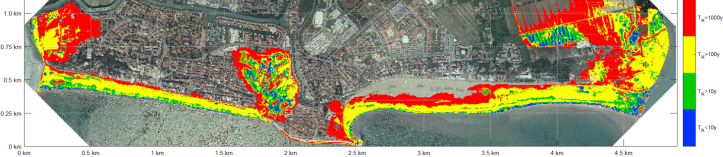
Howto produce a Coastal flooding map.
Exercise in GIS (+python). Mapping the expected value and economic costs related to flooding. Evaluation of Coastal Flooding Index.
Interactions with river discharge and urban flooding (Tidal inlet)
8. Mitigation measures (4h)
Possible adaptation measures (setback strategy, managed realignment, dike, nourishment, water extraction control,…)
9. Flood management tools (2h)
Decision Support Systems for coastal flooding management
10. Modeling coastal flood (2h)
Description of existing models (free operational & commercial)
Exercises in Matlab/Python (6h)
The students will be guided through the implementation of simple exercises in Matlab (or python, if preferred).